Applications
Overview of ECOSTRESS mission applications (download)Learn More


ECOSTRESS (Ecosystem Spaceborne Thermal Radiometer Experiment on Space Station) is a NASA mission designed to measure surface temperatures from the International Space Station (ISS). It captures high-resolution thermal infrared data, providing crucial information for a wide range of Earth science applications:
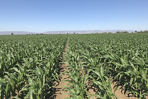
Agriculture Monitoring
Agriculture (download)- Crop Water Stress Detection Drought Monitoring and Management
- Crop Health Monitoring
ECOSTRESS thermal data is used to derive evapotranspiration and evaporative stress index, which can be used to better understand vegetation water stress in crops and at near field scale. Identifying areas where plants are experiencing stress due to insufficient water can support farmers in improving optimization of irrigation, improving water use efficiency and reducing waste.
)
)
)
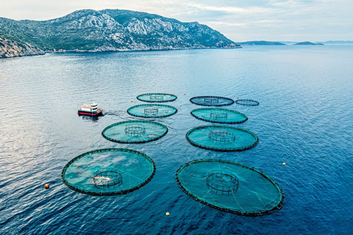
Aquaculture and Fisheries
- Aquaculture Management:
ECOSTRESS provides critical temperature data for aquaculture farms, helping to monitor water conditions for fish, shrimp, and shellfish cultivation. By detecting temperature changes that may affect growth rates or lead to heat stress, ECOSTRESS supports the optimization of farming practices, ensuring higher yields and reducing mortality rates. High temperatures in aquaculture settings can promote the spread of disease among fish populations. ECOSTRESS data enables early detection of temperature-induced stress, allowing aquaculture operators to implement preventative measures, such as adjusting feeding regimes or oxygen levels, to minimize disease outbreaks.
- Fisheries Monitoring:
ECOSTRESS assists in monitoring coastal ocean temperatures, which influence fish migration patterns and spawning behavior. This information supports sustainable fisheries management by helping predict fish stock locations, optimize fishing efforts, and protect critical habitats like spawning grounds.
- Climate Adaptation Strategies:
For both aquaculture and fisheries, ECOSTRESS data helps develop adaptation strategies to cope with climate-induced temperature changes. By monitoring long-term trends, fishery managers and aquaculture operators can adjust practices, such as changing species or farming locations, to maintain productivity and sustainability under changing climate conditions.
)
)
Biodiversity, Restoration, and Conservation
- Habitat Monitoring:
ECOSTRESS provides data on vegetation health and water stress, which is crucial for monitoring habitats that support biodiversity. This information can guide conservation efforts aimed at protecting endangered species and preserving critical ecosystems.
- Ecosystem Restoration and Conservation Planning:
The data supports the evaluation of restoration efforts by tracking vegetation recovery and condition, nd the success of reforestation initiatives in areas affected by deforestation, wildfires, or other disturbances. ECOSTRESS helps identify ecologically valuable and resilient areas, allowing conservationists to prioritize efforts and design effective protected areas and wildlife corridors.
)
)
)
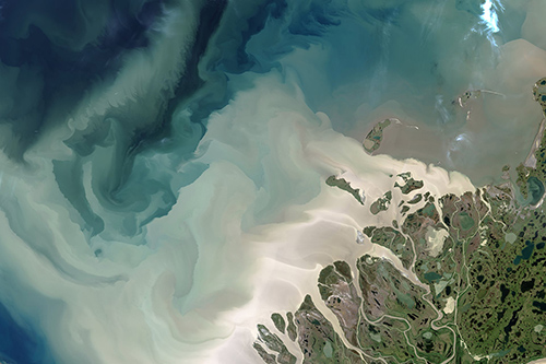
Coastal and Marine Ecosystem Applications
Coastal (download)- Marine Heatwaves and Coral Reefs:
ECOSTRESS tracks sea surface temperatures, enabling the detection of marine heatwaves that threaten coral reefs and coastal ecosystems.
- Coastal Wetlands and Mangroves:
ECOSTRESS provides temperature data that are crucial for monitoring the health of coastal wetlands and mangrove ecosystems. By identifying vegetation stress,, it helps assess the impact of climate change and coastal development on these critical buffers that protect shorelines from erosion and provide habitat for diverse species.
- Estuary and Coastal Water Monitoring:
ECOSTRESS tracks the temperature dynamics of estuaries and coastal waters, offering insights into changes that affect habitat conditions for fish and shellfish populations
- Harmful Algal Blooms (HABs):
ECOSTRESS can detect temperature anomalies in coastal waters that may be associated with conditions favoring harmful algal blooms. Monitoring these temperature changes allows for early detection and tracking of HABs, which can have significant ecological and economic impacts on fisheries, tourism, and public health.
)
)
)
)
)
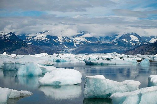
Cryosphere Monitoring and Water Resources Management
- Drought Monitoring:
ECOSTRESS can be used to assess water stress in vegetation, providing essential data for identifying drought conditions and managing water resources effectively.
- Snowpack Conditions:
ECOSTRESS provides valuable thermal data on snow and ice cover, including glaciers, ice sheets, and permafrost regions. Monitoring these areas helps assess melting rates, detect temperature anomalies, and understand their contribution to sea-level rise and changes in the global water cycle.
)
)
)
Geology, Critical Minerals and Volcanoes
Critical Minerals (download)ECOSTRESS provides 5-band emissivity data that can be used to estimate the abundances of silicates based on the distinct spectral features exhibited in the thermal infrared. Silicates are rock-forming minerals and make up approximately 90% of the Earth's crust. Silicates are also a host for rare earth elements, which are minerals essential for many high-tech devices such as cell phones and electric cars. In addition, ECOSTRESS can detect other mineral classes such as sulfates, which presence along with other minerals could indicate hydrothermal features with potential for relevant mineral deposits (e.g. porphyry copper deposits, epithermal gold deposits) and energy generation
)
)
)
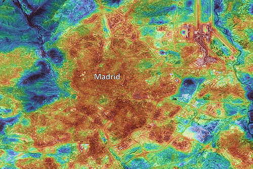
Urban Resilience
Urban Resilience (download)- Urban Heat Islands (UHI)
- Planning and Mitigating heatwaves
- Infrastructure Planning
ECOSTRESS provides detailed thermal imagery that helps identify Urban Heat Islands—areas where temperatures are significantly higher than their surroundings due to human activities, dense infrastructure, and reduced vegetation. This information is crucial for city planners and policymakers to develop cooling strategies, such as increasing green spaces and reflective street and roofing materials, to mitigate these effects. This information has also revealed regions and communities that are disproportionately affected by extreme heat events, which could be used to support future planning and mitigation strategies.
)
)
)
)
)
)
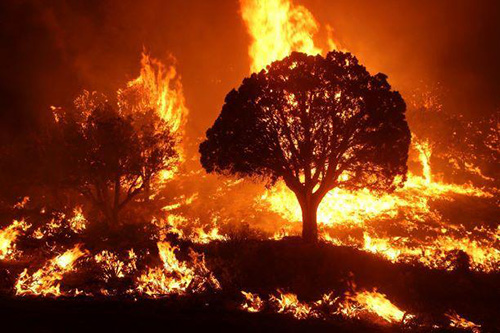
Wildfire Assessment
Wildfire (download)- Pre-Fire Monitoring
ECOSTRESS helps identify areas of vegetation that are increasingly stressed due to drought or high temperatures, making them more vulnerable to ignition. This early detection capability supports proactive fire management and mitigation strategies such as prescribed fires and other fuel reduction approaches to reduce wildfire risk.
- Active Fire Monitoring
ECOSTRESS detects temperature anomalies and active fire hotspots, providing near real-time data critical for wildfire detection, tracking fire behavior, and supporting rapid response efforts by firefighting teams.
- Post-Fire Assessment
After a fire, ECOSTRESS monitors burn scars and soil temperatures to assess the severity and extent of damage. This data can aid in recovery planning, reforestation efforts, and assessing risks such as soil erosion and flash floods in burned areas.
)
)
)
)
)
)
Overall, ECOSTRESS is a versatile tool for monitoring Earth’s thermal dynamics, supporting sustainable agricultural practices, environmental management, public health initiatives, biodiversity conservation, ecosystem restoration, water resource management, cryosphere studies, wildfire management, coastal and marine research, urban heat management, and hazard mitigation strategies.